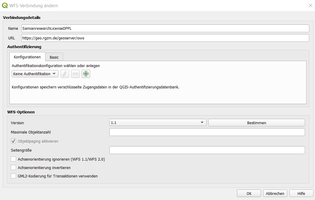
Enter the ULR of the ows: https://geo.rgzm.de/geoserver/ows
Please note: from QGIS 3 onwards, set version to 1.1

and can be stored as csv
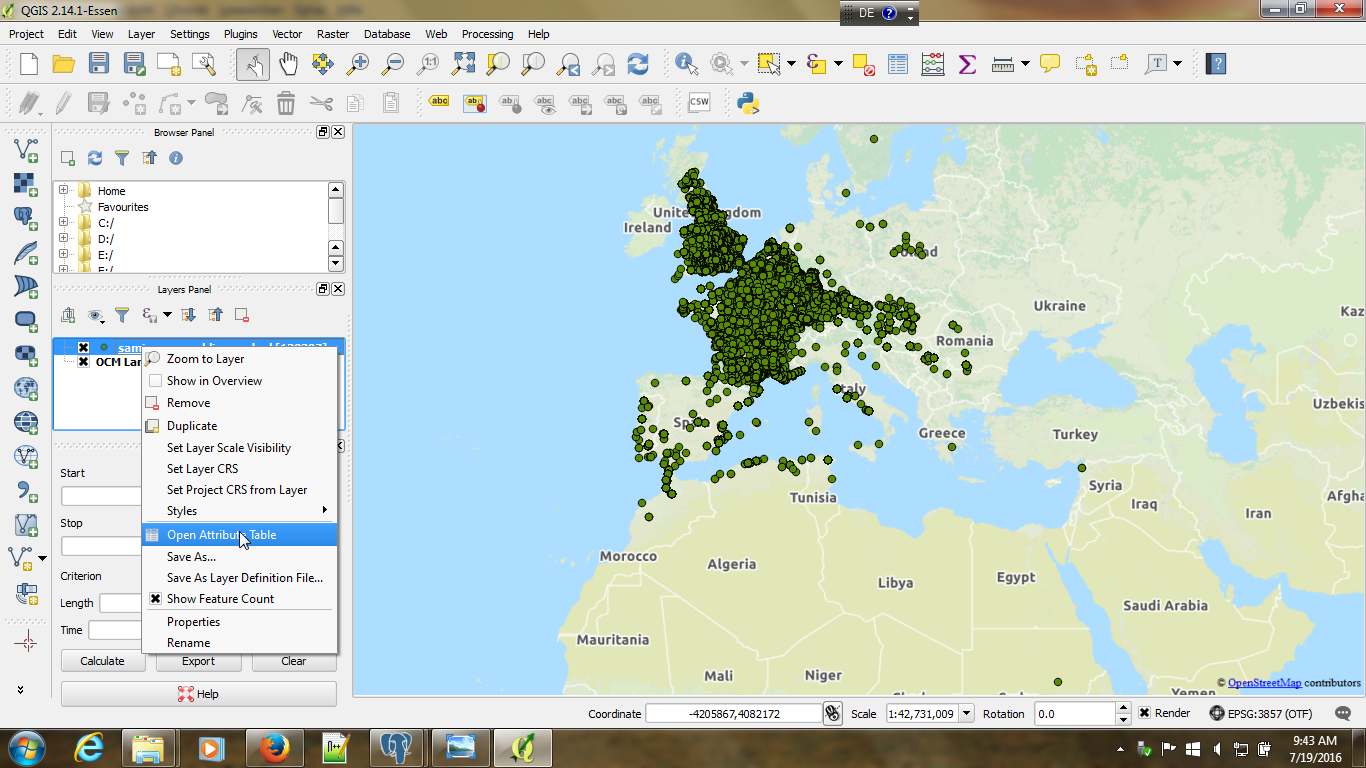
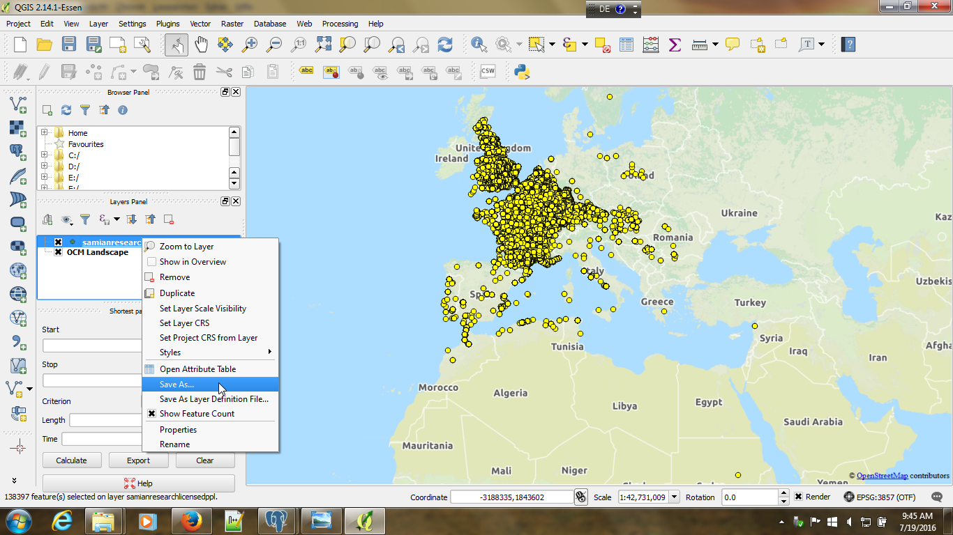
Read the modular DPPL License Agreement before you do this.
In the context of our Open Access policy, the Samian Research data is also available as a web feature service, which you can use e.g. in the freeware QGIS program. By using this Web Feature Service, you are always realtime connected with the latest version of the Samian Research project data.
See the modular DPPL License Agreement.
| How to use this service: | ||
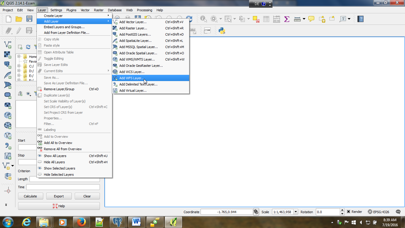
| Open QGIS |
|
|
| Ad wfs Layer |
|
|
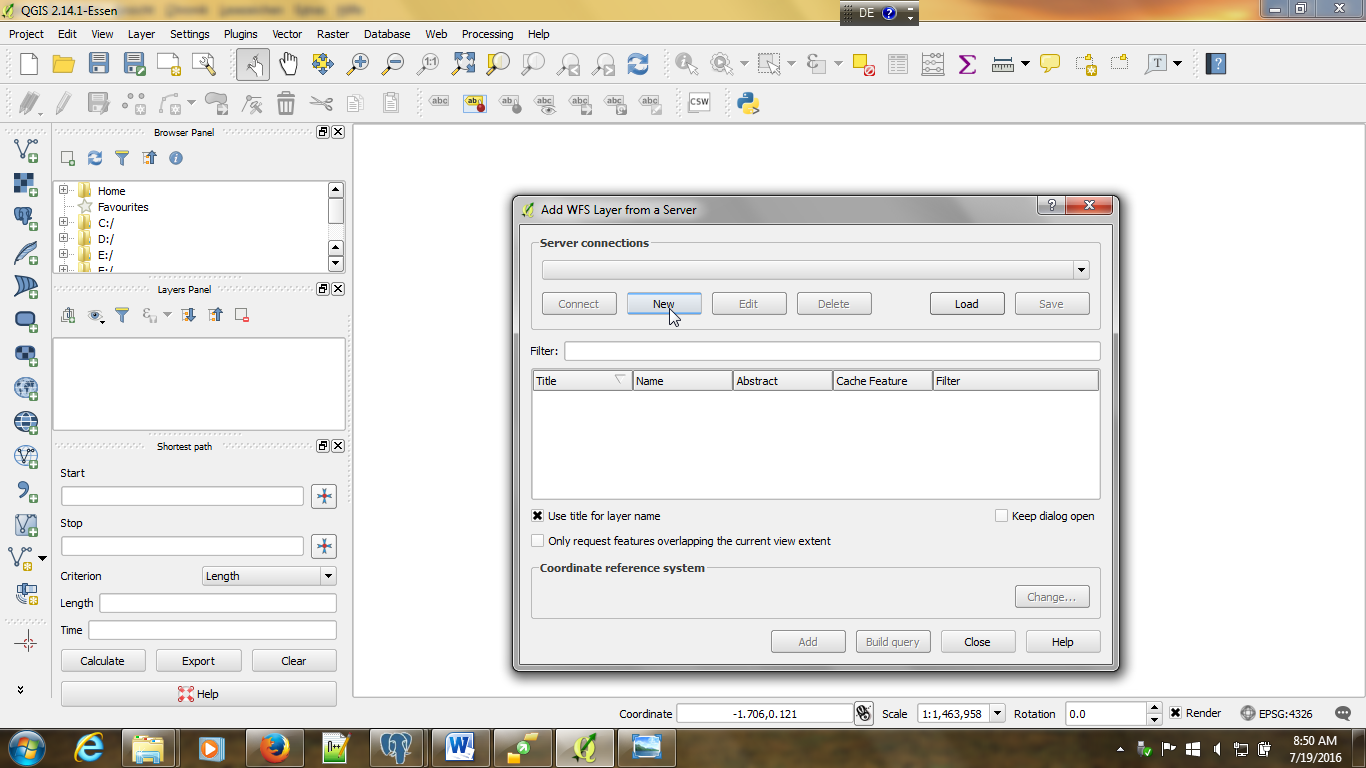
| Setup a new server connection | |
|
Enter the ULR of the ows: https://geo.rgzm.de/geoserver/ows Please note: from QGIS 3 onwards, set version to 1.1 |
|
|
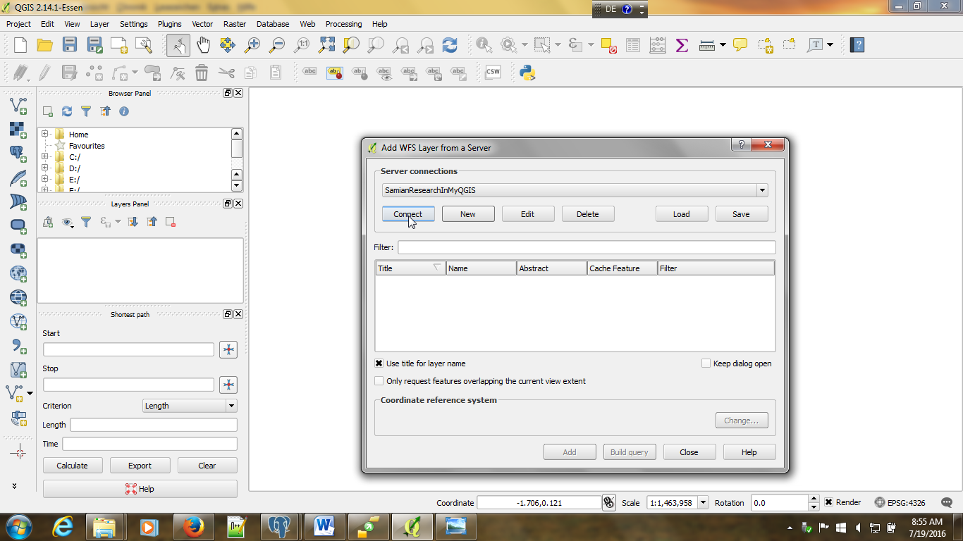
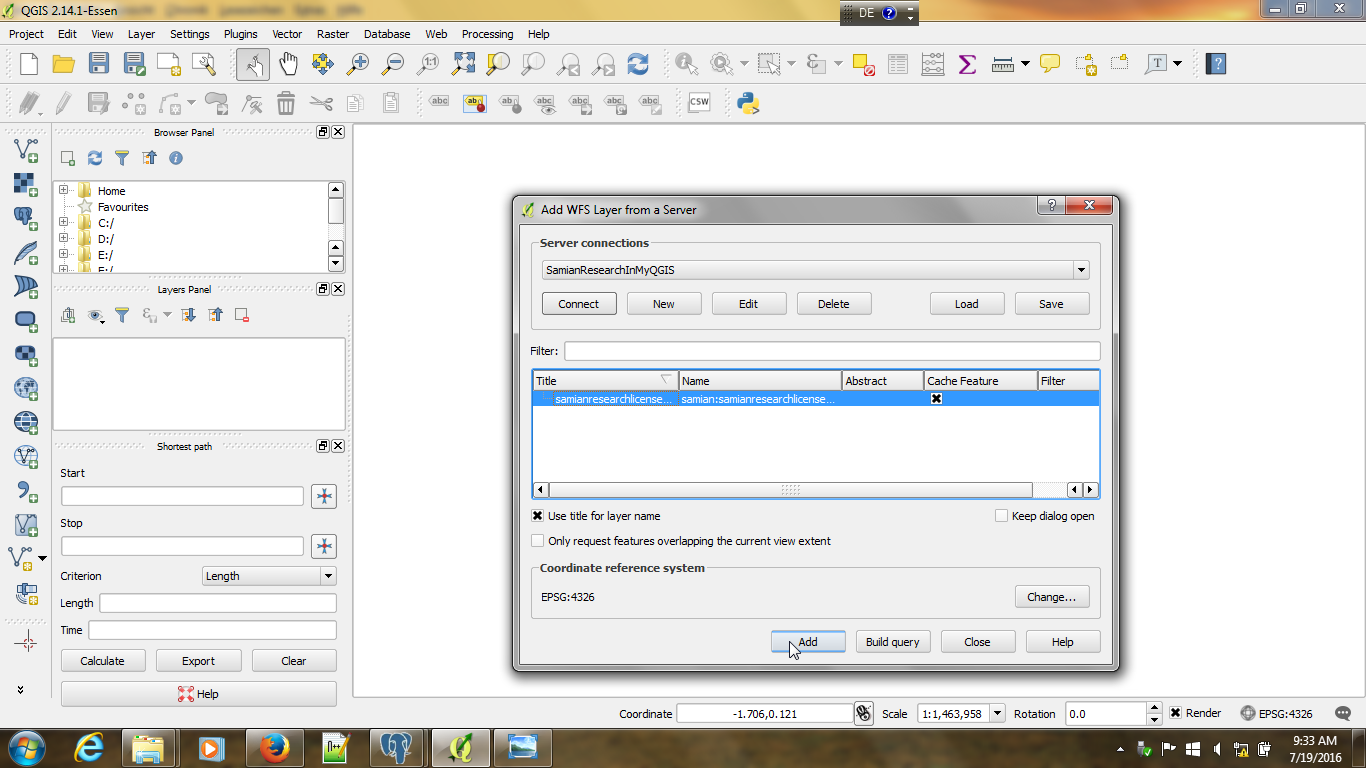
| Connect to the ows SamianresearchLicenseDPPL | |
|
| Click on Add SamianresearchLicenseDPPL | |
|
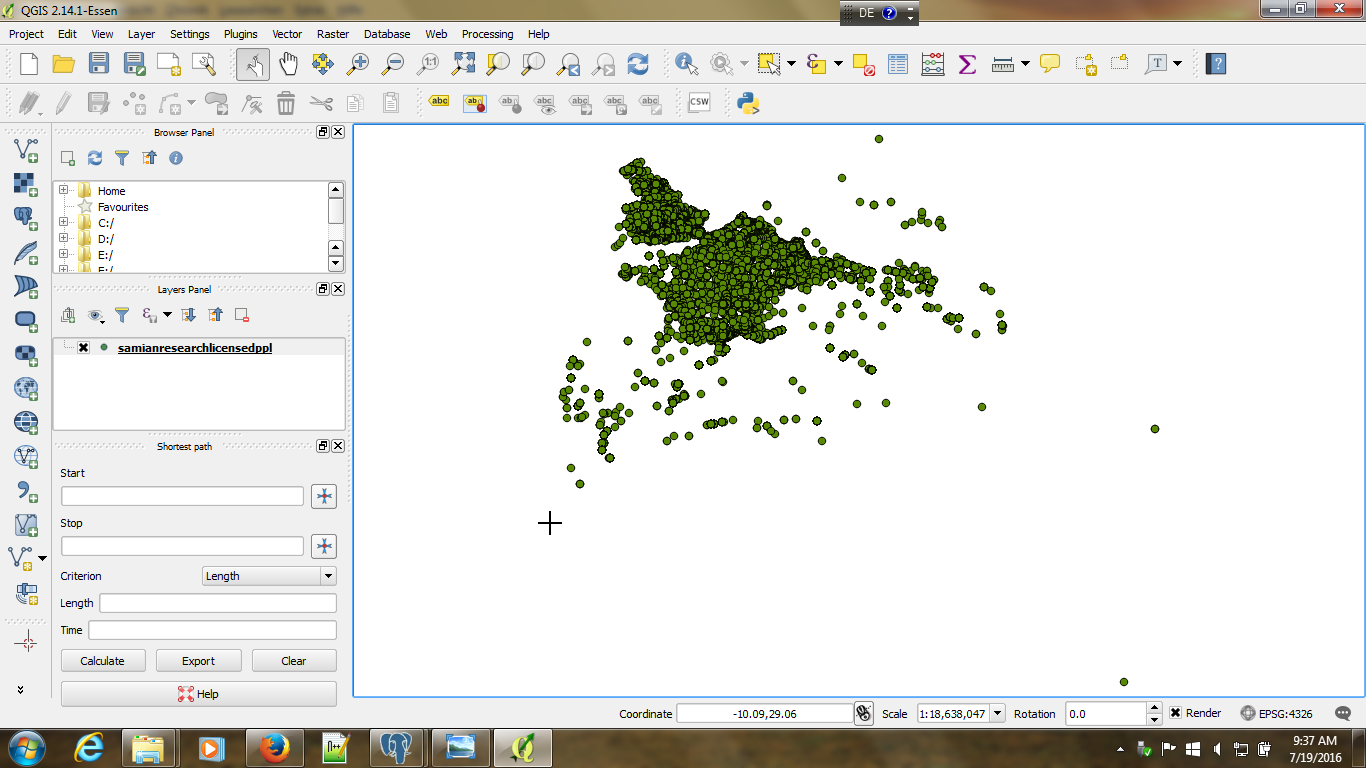
| Loading may take a while. The distribution dots appear | |
|
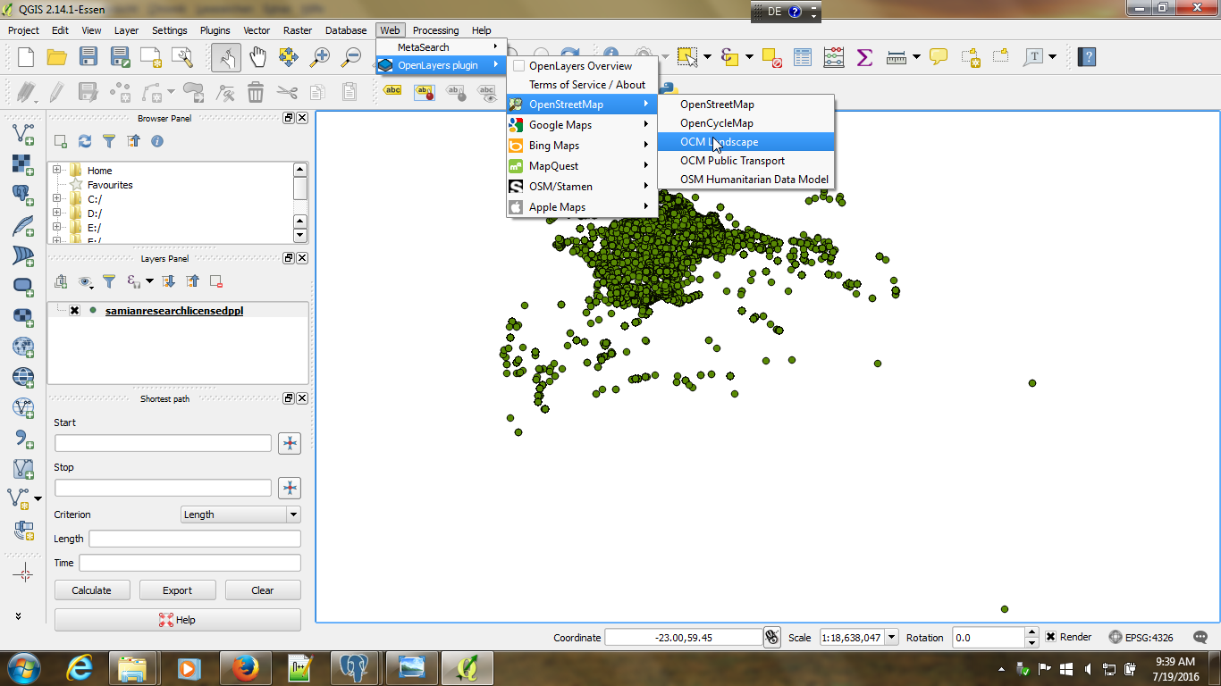
| Add an OpenStreetmap landscape (make sure the OpenLayers-Plugin is installed) | |
|
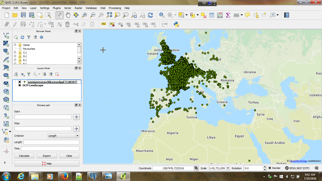
| The OpenStreetmap landscape is now visible. Make sure the landscape is listed in the right order in the pane on the left side | |
|
| To access the underlying full data, you use the right click mouse | |
|
| The data are now accesible | |
|
and can be stored as csv Read the modular DPPL License Agreement before you do this. |
|
|
You may apply for further information at the RGZM